Oceania Mapping the Mysteries of Pacific Islands
Oceania, an enchanting expanse of azure waters, untouched shores, and vibrant cultures, awaits exploration. Stretching across the vastness of the Pacific, this collection of islands, each with its own unique narrative, forms a mesmerizing mosaic. But to truly unearth the treasures of Oceania, delving deep into its cartography is essential. In this collection, we present an array of maps, capturing the multifaceted essence of this region, revealing its topography, heritage, and intricate socio-political dynamics.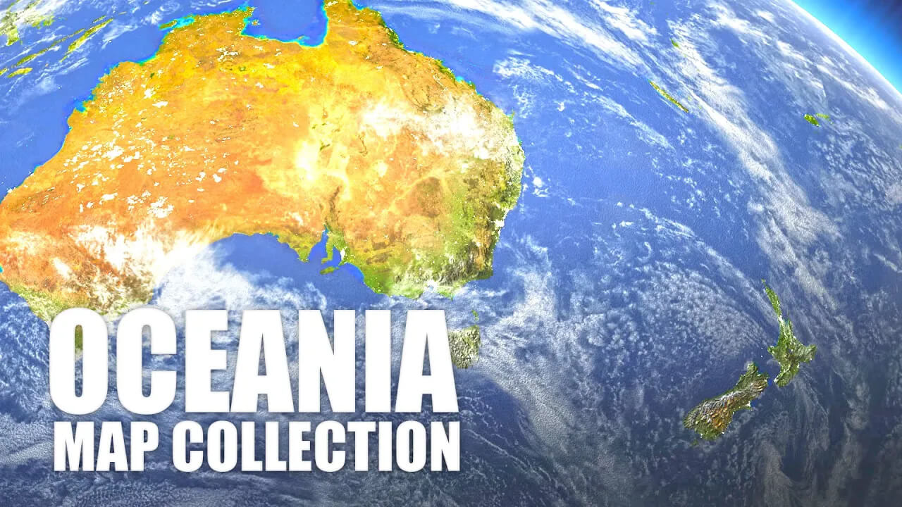
Oceania Uncharted: Mapping the Mysteries of Pacific Islands and Their Vast Surroundings
Please subscribe on "World Guide" channnel on Youtube at youtube.com/c/WorldGuide
For the keen geographer, the wanderlust-driven traveler, the eager student, or the simply curious, this compilation is a treasure trove. We've curated maps that highlight not just the physical beauty of Oceania, but also the linguistic and cultural diversities that make it so enthralling. Join us in navigating the vast, intricate, and beautiful realm of Oceania through these detailed maps, each offering a unique perspective and a tale of its own.
1. Oceania Physical Map
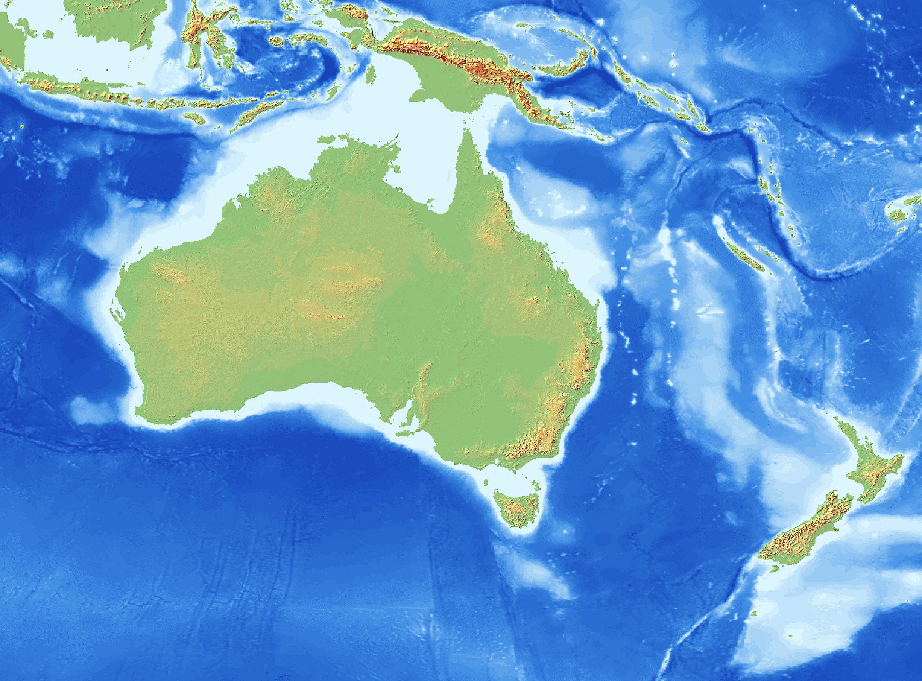
Discover Oceania's natural landscapes – its mountain ranges, plateaus, and coastlines. A physical map offers a clear visual of the landforms and water bodies that make up this diverse region.
2. Oceania Political Map
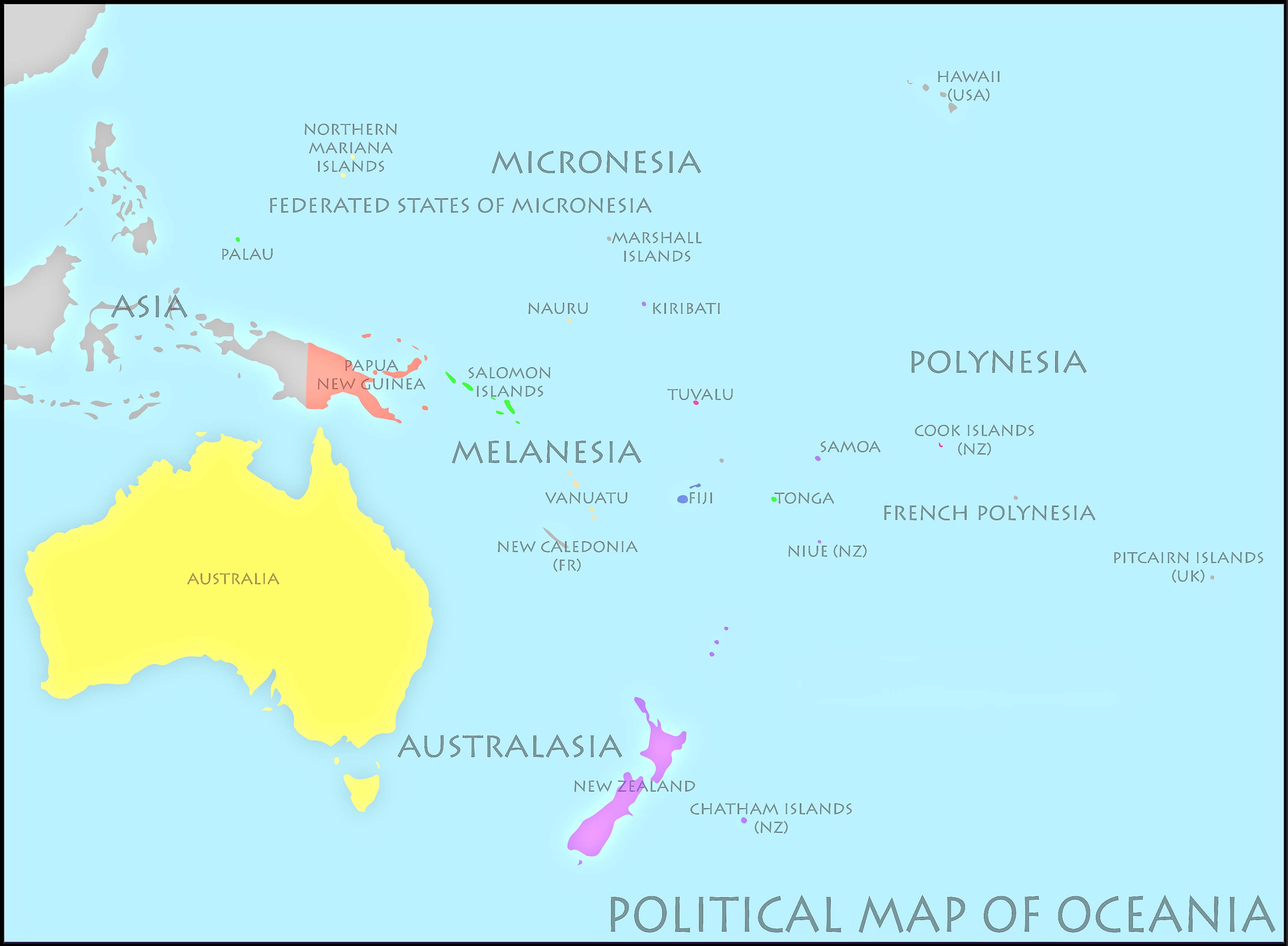
Get an overview of the countries, states, and territories within Oceania. Understand the boundaries and political divisions of nations like Australia, Papua New Guinea, Fiji, and others.
3. Oceania Topographic Map
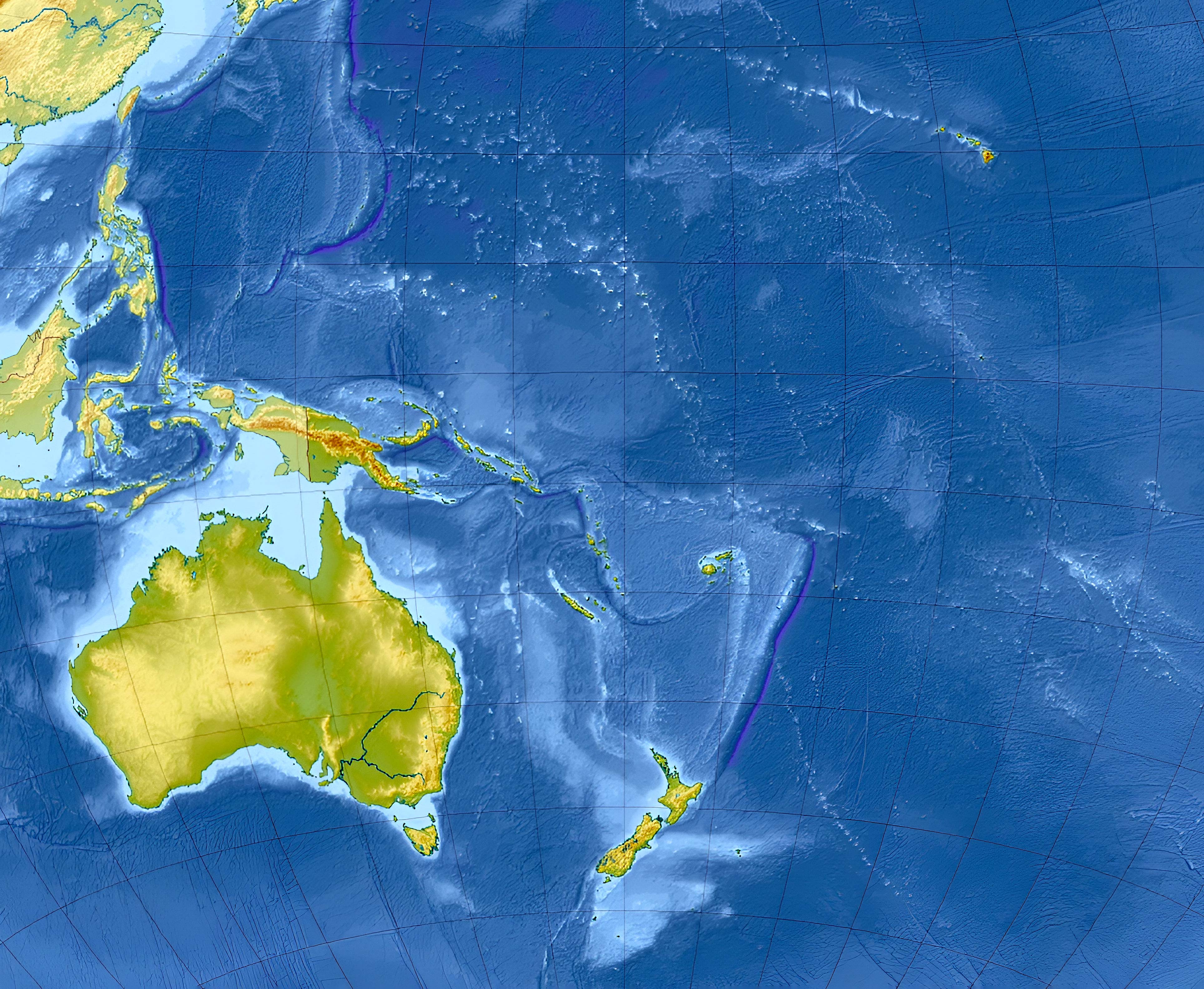
With contour lines depicting elevations, a topographic map provides a 3D sense of Oceania's terrain. Perfect for hikers or researchers keen on understanding the elevation levels.
4. Australia Geological Map

Delve into the ancient rocks and mineral resources of Australia. This map reveals the types of rocks found at different locations and their ages.
5. Oceania Cities (Urban) Map

From Sydney's sprawling metropolis to Suva's vibrant streets, explore the cities of Oceania and their significant urban centers.
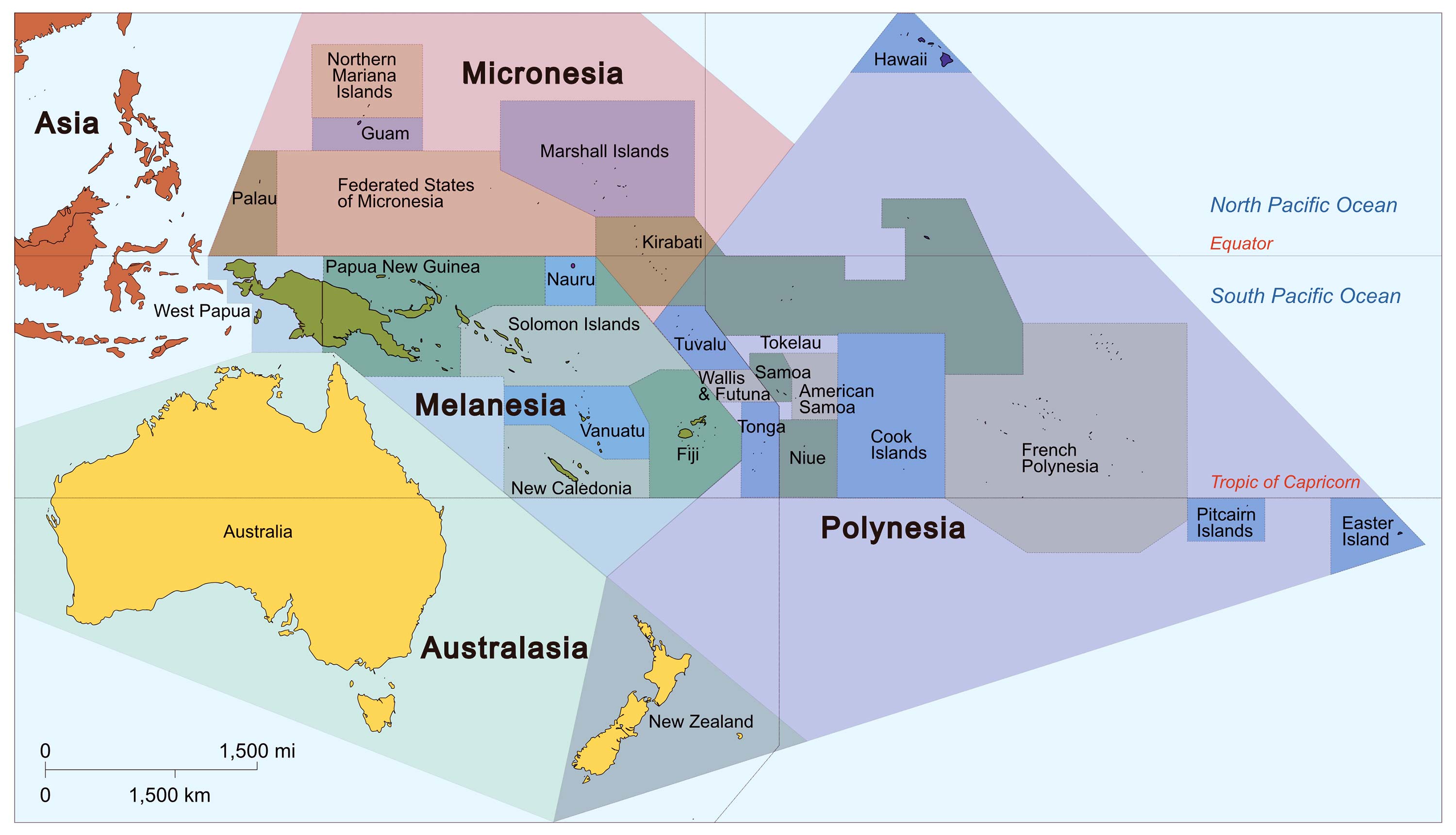
6. Oceania Regions Map (UN Geoscheme)
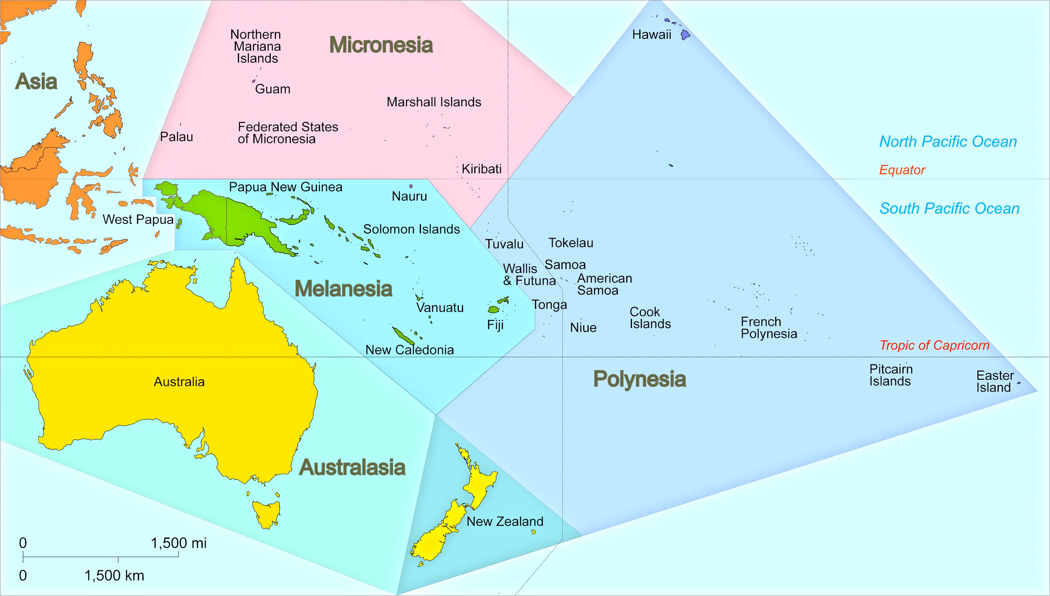
Breakdown Oceania into its distinctive regions. Whether it's Polynesia, Micronesia, or Melanesia, learn about the areas that collectively form Oceania.
7. Countries and Capitals of the Oceania
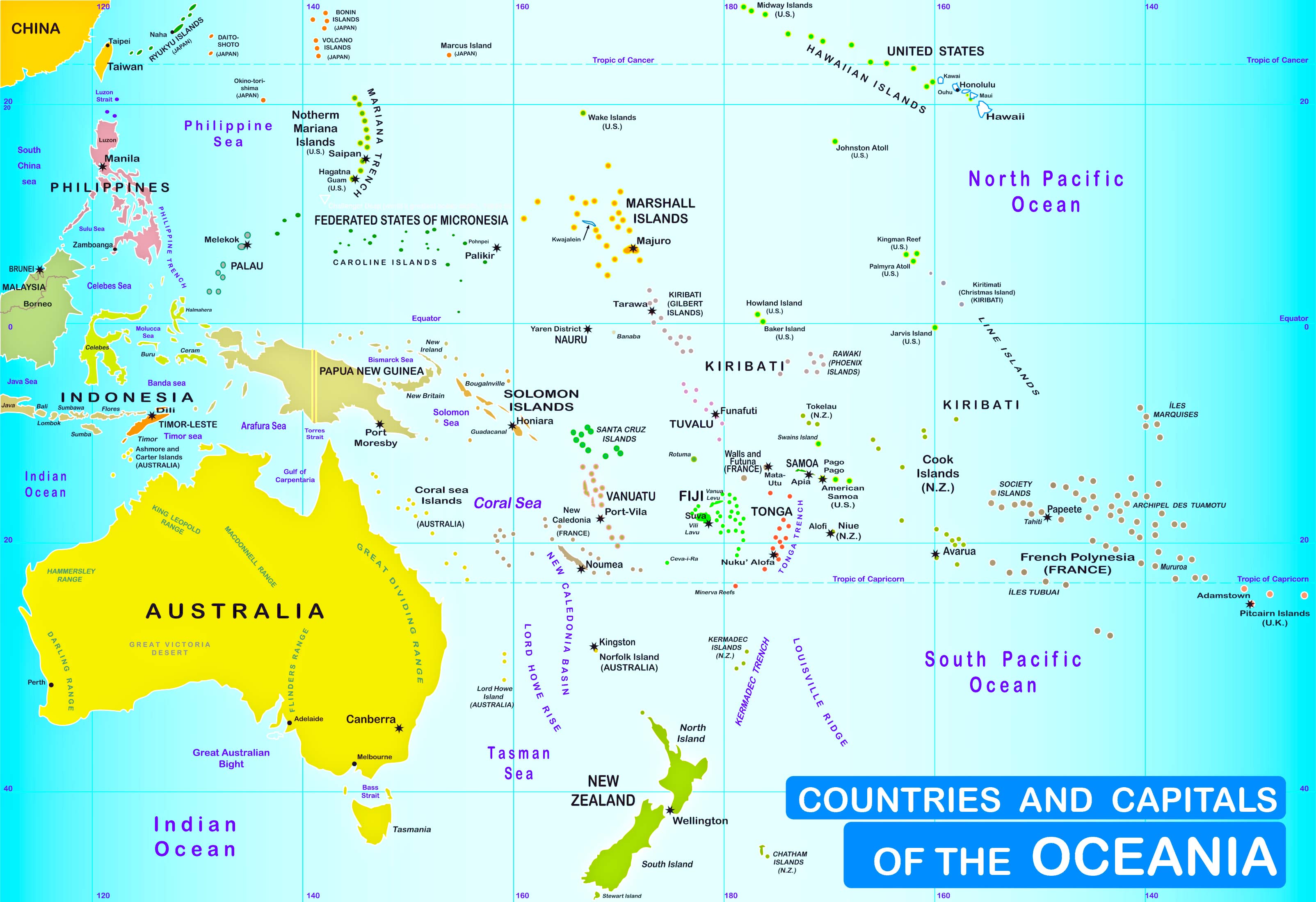
8. Oceania Exclusive Economic Zones Map
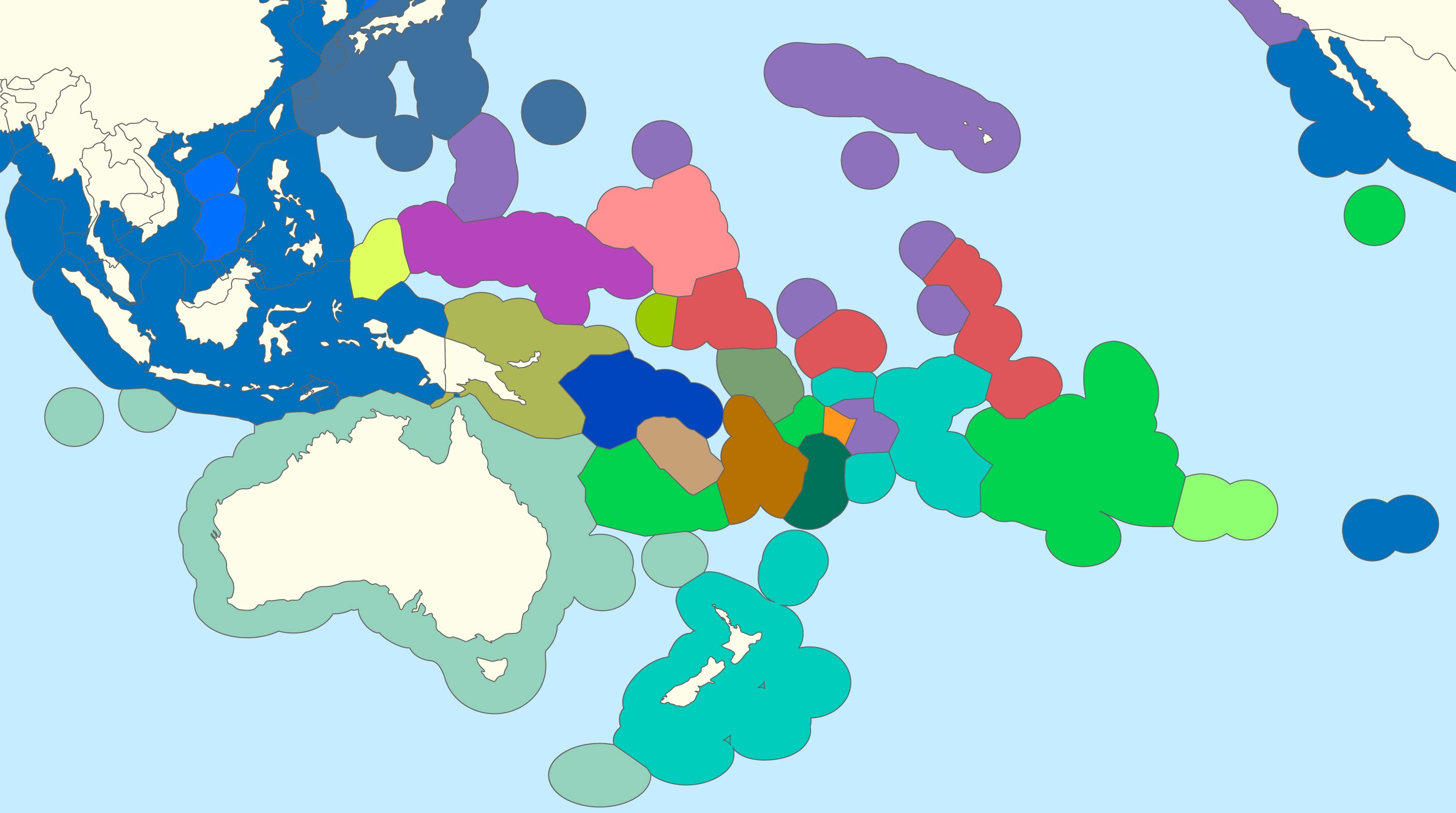
9. Oceania Relief Map
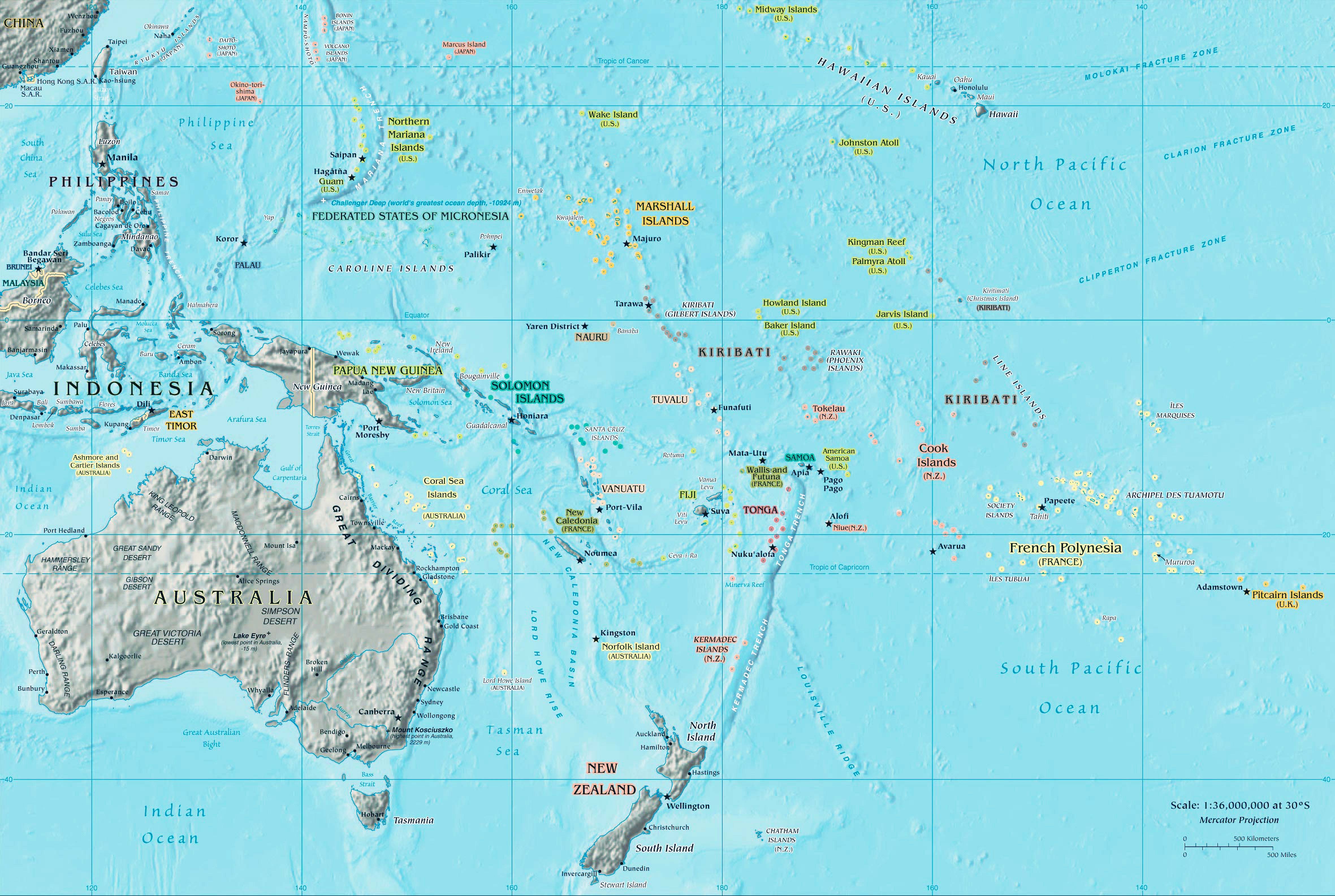
With shaded areas depicting elevations, this map gives a visual sense of the relief features of the land.
10. Oceania Countries and Subregions Map
11. Oceania Historical Map (1852)
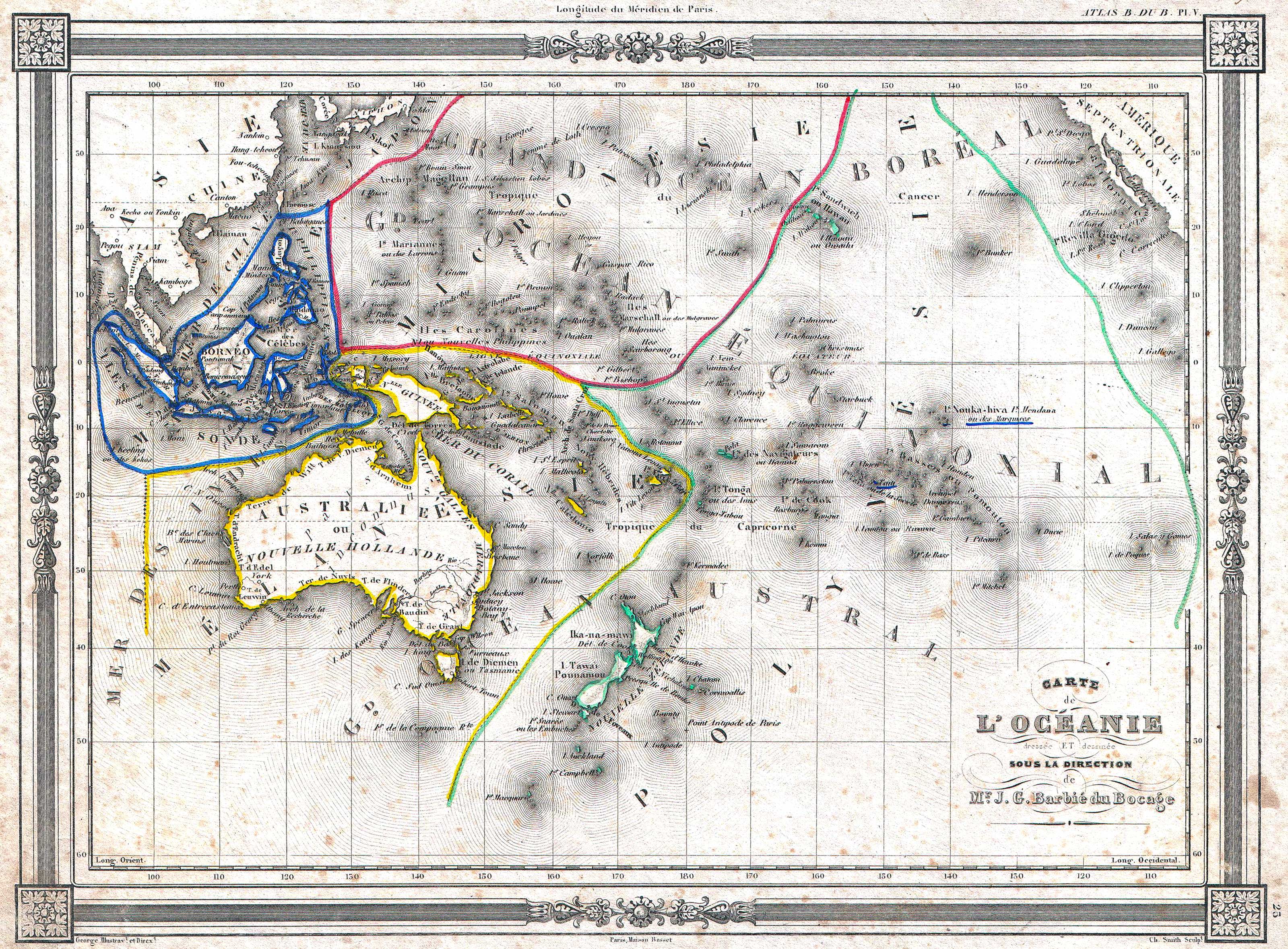
A distinctive and beautifully crafted 1852 Oceania map by J. G. Barbié du Bocage. It encompasses regions such as Australia, New Zealand, Polynesia, Micronesia, Melanesia, and Malaysia. In this map, Australia is termed "pays inconnu" and is also referred to as "New Holland". Hawaii is depicted as the "Sandwich Islands". The map boasts an elegant frame-like border. It was produced by J. G. Barbié du Bocage for inclusion as the 25th plate in Maison Basset's 1852 version of the Atlas illustré. (Source: Wikipedia)
12. Oceania Blank Map
13. Oceania Atlas Map
14. Oceania Climate Map
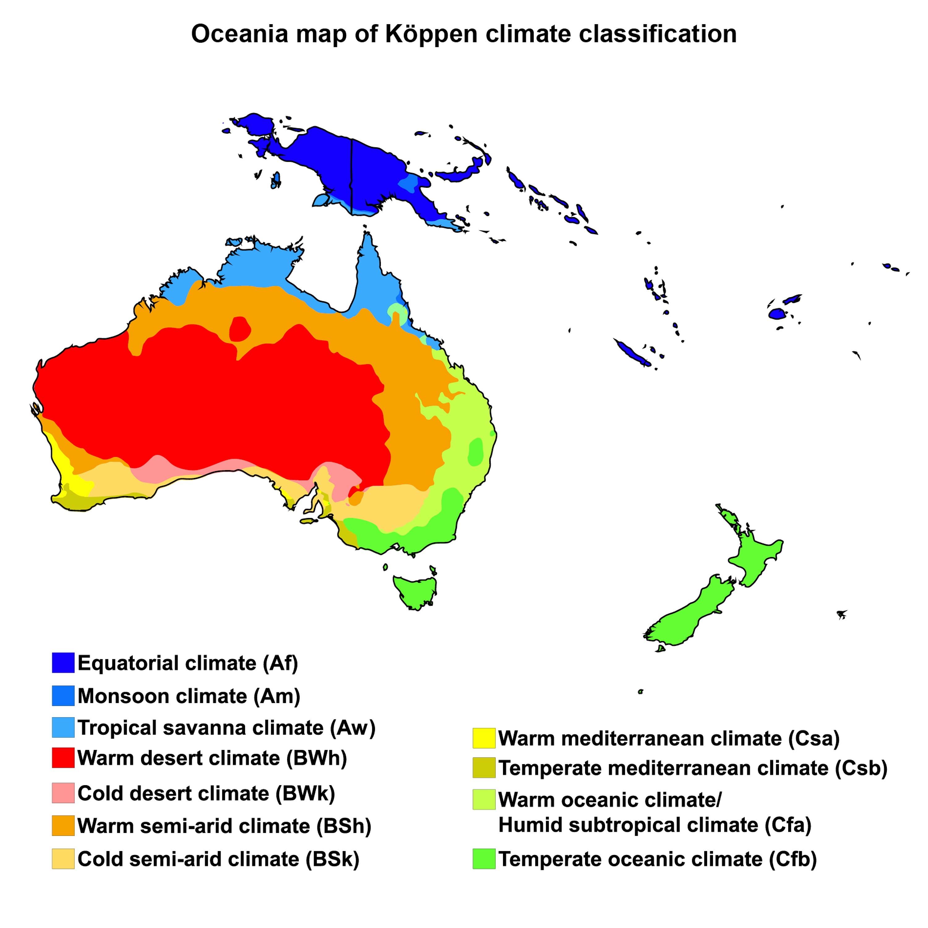
From tropical rainforests to arid deserts, understand Oceania's diverse climates with this colorful and informative map.
15. Oceania Flag Map
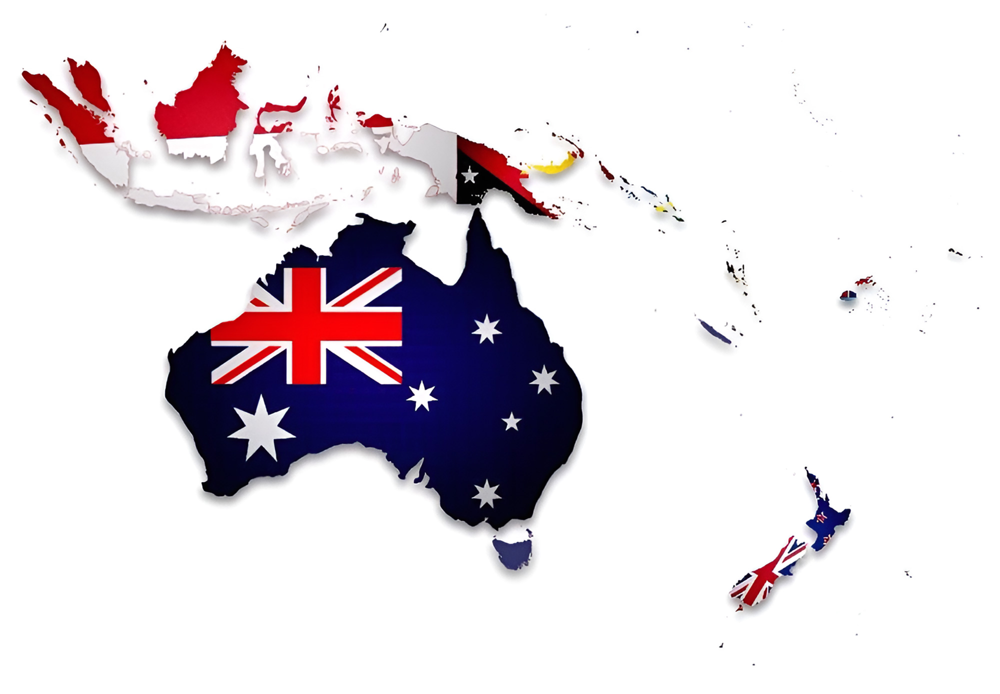
A blend of cartography and art, the flag map overlays the flags of Oceania countries on their respective territories.
16. Australia Travel Map

Pinpoint tourist hotspots, attractions, and must-visit destinations across Australia.
17. Oceania 3D Earth Map
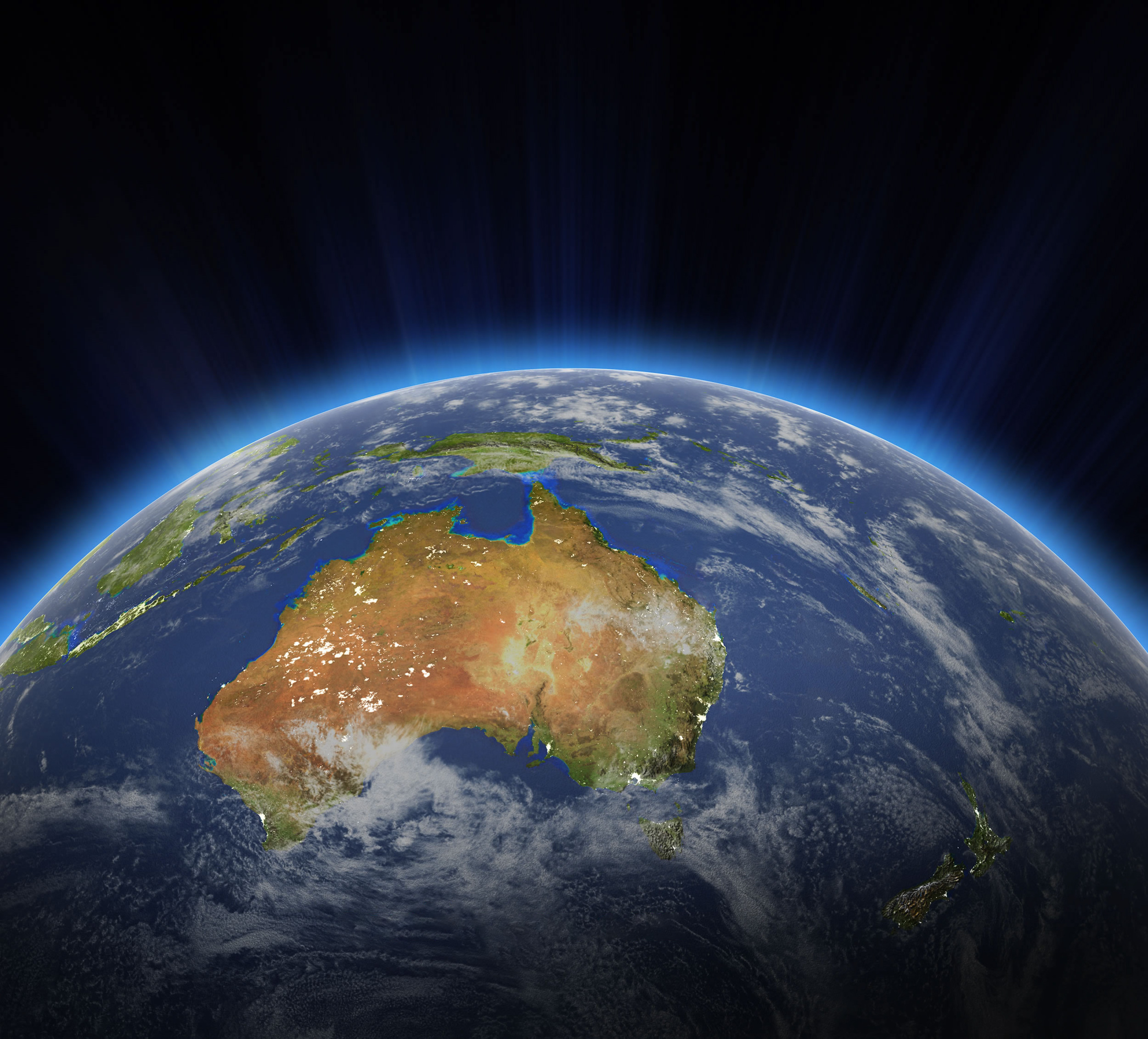
Delving into Oceania's expansive landscapes and vibrant cultures is an enlightening journey, especially through the lens of cartography. With our meticulously curated collection of Oceania maps, we aim to offer in-depth insights, be it for scholarly research, travel planning, or pure geographical passion. For a comprehensive view of this remarkable region, ensure you've bookmarked this invaluable resource, and consider sharing it with others who share your zeal for maps and exploration.
Feel free to explore these pages as well:
- Head of Performance Marketing
- Head of SEO
- Linkedin Profile: linkedin.com/in/arifcagrici
Web: istanbul-city-guide.com
Email: [email protected]
Phone: +358 44 934 9129
Copyright istanbul-city-guide.com - 2004 - 2025. All rights reserved. Privacy Policy | Disclaimer
